Translate

Australian Camels


Camel Hunting

Forget adrenaline sports – a new initiative to relieve frustrated Aboriginal youths in the interiors of Australia, has them camel hunting .


Substance abuse and alcoholism are rampant among teenagers in remote Aboriginal settlements like Kintore, in central Australia, where there are hardly any (legal) recreational opportunities to speak of. This has worried substance abuse task force experts enough to initiate camel hunting expeditions for these youngsters to channel their energy.


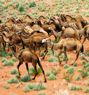
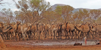
The camels themselves are not native Australian. Brought over from India in the 19th century for load carrying purposes, they have grown in number to become a nuisance.
They threaten fragile desert ecosystems, and destroy property.


The community of Docker River in the Northern Territory  was under siege by 6,000 marauding wild camels, before being culled.


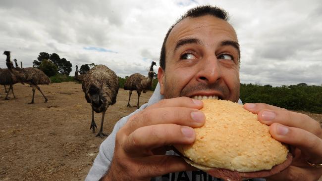
Camel hunting expeditions consist of teenagers accompanied by one of Kintore’s three police officers. Once an animal has been shot, it is butchered and the meat is taken back into the settlement to be shared with the elders of the community.


Camel Hunting can provide a lot of food for the community, and help save the outback Eco-system.

View Camel Recipes http://outbackcooking.blogspot.com/2009/05/camel-recipes.html
.

Quoll native cat


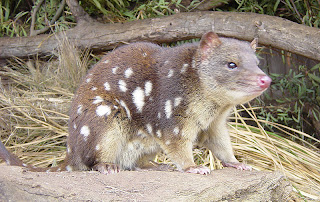
British explorer Captain Cook collected quolls along the east coast of Australia in 1770, and recorded "quoll" as their local Aboriginal name. Quolls were often seen in later years by early settlers, who called them "native cat", "native polecat" and "spotted marten", names based on familiar European animals.


Quolls or native cats (genus Dasyurus) are carnivorous marsupials, native to Australia and Papua New Guinea. Adults are between 25 and 75 centimetres (30 in) long, with hairy tails about 20 to 35 centimetres (14 in) long. Females have six to eight nipples and develop a pouch—which opens towards the tail—only during the breeding season, when they are rearing young. Quolls live both in forests and in open valley land. Though primarily ground-dwelling, they have developed secondary arboreal characteristics. They do not have prehensile tails, but do have ridges on the pads of their feet,to walk the rough ground. Their molars and canines are strongly developed.


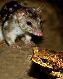
Cane toads have driven the northern quoll to extinction in many parts of northern Australia and they are threatening to invade Western Australia's Kimberley regions, one of the quoll's last strongholds.


But a University of Sydney project revealed in 2010 is teaching them to avoid eating the invasive amphibians.

Before releasing the quolls into the wild, Professor Rick Shine, Stephanie O'Donnell and Dr Jonathan Webb fed each marsupial a small dead cane toad.
The toads were not large enough to kill the quolls, but they were laced with a chemical that made the quolls feel nauseous.
Dr Webb said the quolls quickly learned to avoid eating toads.


The tribe Dasyurini to which quolls belong also includes the Tasmanian devil, antechinuses, the Kowari, and mulgaras, which makes him a relative of Taz the Tasmanian Devil.


Country Women’s Association CWA


The Country Women’s Association of Australia (commonly abbreviated as CWA) is the largest women's organisation in Australia. It has 44,000 members across 1855 branches. Its aims are to improve the conditions for country women and children and to try to make life better for women and their families, especially those women living in rural and remote Australia. The organisation is self-funded, non-party-political and non-sectarian.


The Country Women's Association was formed in both New South Wales and Queensland in 1922. By 1936 there was a branch in each of the States and territories of Australia.

During WWII, most CWA efforts were redirected to supporting the war effort. They entertained and fed men in country training camps, supported the Australian Comforts Fund and knitted garments for soldiers. They particularly took on the task of making camouflage netting for the army from 1942. Over 400 camouflage netting circles were established, producing hundreds of thousands of nets by early 1944. Many members were also left to run the family farm while their husbands were away fighting.


Volunteers from the Country Women’s Association (CWA) packing Australian Comforts Fund (ACF) parcels for sending overseas to service personnel during WWII.


In the postwar years the CWA took an interest in welcoming new migrants – meeting at least two ships a months and providing catering for 1000-2500 migrants a time. They also helped families settle and invited women to branch meetings. Special services were set up for migrant women living in the snowy Mountains


 In 1992, the  Country Women’s Association of Australia was awarded the RSL Anzac Peace Prize in recognition of their outstanding effort in promoting international understanding and contributing to world peace in accordance with best traditions exemplified by the ANZAC spirit.

Today the  Country Women’s Association  awards student scholarships as well as providing instruction and encouraging participation in the fields of drama, art, music, public speaking, cooking and floral art. The organisation runs workshops for older members on how to use computers, electronic banking and ATMs. Submissions are made to governments at all levels on a wide variety of social issues.

Country Women’s Association of Australia is a member of the Associated Country Women of the World, which has non-government organisation status at the United Nations. ACWW has over 9 million members in 62 countries around the world.


In Queensland Younger Sets are a section of the Queensland Country Women’s Association, which is designed especially for young women (married or single). Girls can be members of a Younger Set up to the age of 25. A Younger Set is made up of girls who participate in arts and craft, cookery, international work, hold positions in their Set (such as president, treasurer, international officer, secretary and vice president), community work and fundraising.


The biggest event for Younger Sets each year is Leadership School. Leadership School is a week-long camp which is created as a youth network throughout Queensland drawing together young women from Younger Set’s all over the state. It is held in a different part of Queensland each year during the September School Holidays and is attended by Younger Set members and Associate Members who are 12 and over. Leadership School provides many different competitions allowing girls from each Set to compete against each other. It also has a large range of exciting activities such as Public Speaking, Debating, Handcraft, Outings, and much more!


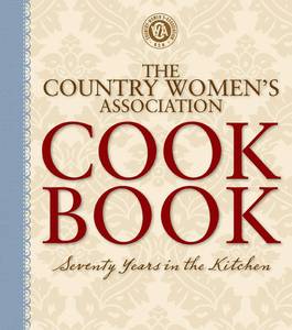
Country Women's Association Cook Book
This book is an essential reference for every cook, offering helpful advice and handy hints that have stood the test of time, and a unique insight into the kitchens of the past. You will love this wonderful cookbook which has been inspiring Australian women for generations.
These delightful recipes traverse every aspect of the culinary world, from starters, appetisers and mains to delightful cakes, pastries and desserts, with special sections on home-made jams and preserves, pickles and chutneys, sweets, beverages and more. get it at there website http://www.cwaofnsw.org.au/merchandise/home.do


Its stated aims are

To bring all women and families together and form a network of support.
To provide a forum for the voice of all women in Australia.
To improve conditions and welfare of all women and families especially in country areas.
To support schemes which enhance the value of country living, especially health and educational facilities.
To encourage development in regional areas and to increase the viability of rural communities and the environment.
To provide a voice to Government at all levels.
To promote International goodwill friendship understanding and tolerance between all people.


Motto

Honour to God
Loyalty to the Throne
Service to the Country
Through Country Women
For Country Women
By Country Women

Lord Howe Island

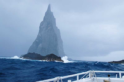
Worlds largest ocean stack Balls Pyramid off Lord Howe Island


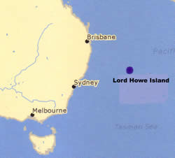
Lord Howe Island is a small island in the Tasman Sea 600 kilometres (370 miles) east of the Australian mainland, and is part of the Mid-North Coast Statistical Division of New South Wales, Australia.


Lord Howe island is roughly crescent-shaped, about 10 kilometres (6.2 miles) long and 2 kilometres (1.2 miles) wide. It is an eroded remnant of a 7 million-year-old shield volcano. The crescent of the island protects a coral reef and lagoon.
Mount Lidgbird 777 metres (2,549 ft) and Mount Gower 875 meters (2,871 ft) dominate the south end of the island, are remnants of lava flows that once filled a large volcanic caldera.
These lava flows occurred 6.4 million years ago, and were the last volcanic events on the island, which has subsequently eroded to what remains today.


Lord Howe Island was discovered on 17 February 1788, by HMS Supply, commanded by Lieutenant Henry Lidgbird Ball, RN, who was on his way from Botany Bay to Norfolk Island with convicts to start a penal settlement there. On his return journey on 13 March 1788, he sent a party ashore on the island. It was uninhabited, and it seems that it had not been known to any of the Polynesian peoples of the South Pacific. Whilst Mount Lidgbird on the island and the nearby Balls Pyramid are named after Ball, the island itself was named after Richard Howe, 1st Earl Howe, who was First Lord of the Admiralty.

Only one native mammall remains on the island, the Large Forest Bat, there are two terrestrial reptiles that are native to the island, a skink and a gecko. Both are rare on the main island but more common on smaller islands offshore. The Garden Skink and the Bleating Tree Frog  have been accidentally introduced from the Australian mainland in recent years.


Lord Howe is also Australia’s premier bird watching destination, with over 14 species of seabirds nesting on the island

Lord Howe Island, with its adjacent islets, is an important breeding site for several kinds of seabirds. They include the Providence Petrel, for which the island was its only breeding location for many years after the breeding colony on Norfolk Island was exterminated in the late 19th century.
Species of landbirds that breed on the island group include an iconic endemic rail, the Lord Howe Woodhen, and three endemic passerine subspecies of the Golden Whistler, Silvereye and Currawong.
The Flesh-footed Shearwater breeds in very large numbers in summer; its chicks were heavily harvested by the islanders for food.
Masked Boobies are the largest seabirds breeding on Lord Howe island.


Fishing
On Lord Howe Island you can hand-feed the metre-long kingfish at Neds Beach, or try your hand at catching one off-shore from one of the local sports fishing boats.


Diving

Lord Howe Island has a mind blowing and isolated scuba diving site which was only discovered six years ago. Ball's Pyramid is the best diving Lord Howe Island has to offer - we encounter large schools of fish and huge hard, soft and black corals, gorgonia, stingrays, turtles and sharks.


How to get there!

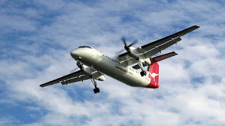
QantasLink offers year-round scheduled services to Lord Howe Island. Flight time is under two hours, with flights departing from Sydney on most days, and from Brisbane on weekends.

A seasonal weekly service to the Island is also available direct from Port Macquarie from February to June and September to December.
There are connecting services with Qantas from all Australian capital cities and with QantasLink from many regional centres.



The Torres Strait Islands


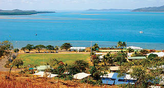
Gabba Island or Pig island

The Torres Strait Islands are a group of at least 274 small islands which lie in Torres Strait, the waterway separating far northern continental Australia's Cape York Peninsula and the island of New Guinea. They are mostly part of Queensland Australia, a few islands very close to the coast of mainland New Guinea belong to the Western Province of Papua New Guinea. Population is approx 48,000


The Torres Strait Islands are distributed across an area of some 48,000 km². The distance across the Strait from Cape York to New Guinea is approximately 150 km at the narrowest point; The Torres Strait Islands lie scattered in between, extending some 200–300 km from furthest east to furthest west.


Waier Island


Culture

The indigenous people of the Torres Strait have a distinct culture which has slight variants on the different islands where they live. They are a sea-faring people, and engaged in trade with people of Papua New Guinea. The culture is complex, with some Australian elements, some Papuan elements, and Austronesian elements, just like the languages. The Islanders seem to have been the dominant culture for many centuries, and neighbouring Aboriginal and Papuan cultures show some Island influence in religious ceremonies and the like.

Thursday Island, also known as TI or Waiben, is the administrative and commercial centre of the Torres Strait Islands.


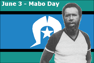
Eddie Mabo Born Murray Island 1936 died 1992

Native Title

Eddie Mabo, a man from the Torres Strait Islands, fought a court case, attempting to assert a legal title over his tribe's traditional lands.
It was a landmark case recognizing native title in Australia for the first time.
A judicial revolution occurred in 1992 when the High Court discarded the doctrine of terra nullius in the Mabo case. The ruling had repercussions for Indigenous peoples within Australia and around the world, especially in Canada, New Zealand, and the United States.


Language

There are two indigenous languages spoken on the islands: the Western-Central Torres Strait Language (called by various names, including Kala Lagaw Ya, Kalaw Kawaw Ya and Kowrareg), and the Eastern Torres Language Meriam Mir. One language, Torres Strait Creole, or Brokan, is used throughout Torres Strait, in neighbouring Papua as far as the West Papuan border area, and Cape York, as well as in many Island communities in Mainland Australia. This is a creole English similar to the closely related Tok Pisin in Papua New Guinea.


Getting there
QantasLink (13 13 13; www.qantas.com.au) flies daily from Cairns to Thursday Island (from $480 return). The airport is on Horn Island. Aero Tropics (1300 656 110, 07-4040 1222; www.aero-tropics.com.au) and Regional Pacific Airlines (1300 797 667, 07-4040 1400; www.regionalpacific.com.au) fly weekdays from Cairns to Bamaga (from $280 one way).


There are regular ferry services between Seisia and Thursday Island (one way/return $47/94, one hour) run by Peddells Ferry Service (07-4069 1551; www.peddellsferry.com.au; Engineers Jetty, Thursday Island).


The Pilbara


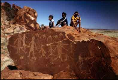
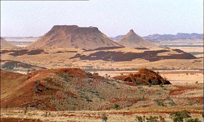
The Pilbara has been occupied for at least 30,000 years.
Archaeological evidence shows that more than thirty distinct socio-linguistic groups lived in the region, utilising and managing the natural resources according to their Law. Pilbara Aboriginal culture, including its intricate social organization and strong spiritual relationship with the land, is still strong today.
The beliefs that Dreamtime beings, who created the land features, control the water and provide food supplies, are still in existence in the land features, is still strongly felt throughout the Pilbara.


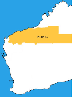
The Pilbara is situated south of the Kimberley, and is made up of the local government areas of Ashburton, East Pilbara, Port Hedland and Roebourne.


The Pilbara Covers some 500,000 square kilometres of land about 1,300 kilometres north of Perth, the Pilbara contains three world class national parks, including Rudall River and Karijini - regarded as one of Australia's most stunning natural assets.

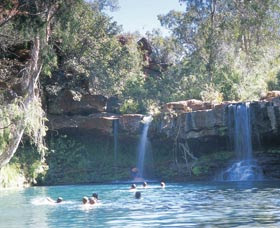
Fern pool Pilbara

It has a population of just under 40,000 people, most of whom live in the western third of the region, in towns such as Port Hedland, Karratha, Wickham, Newman and Marble Bar. A substantial number of people also work in the region on a fly-in/fly-out basis.

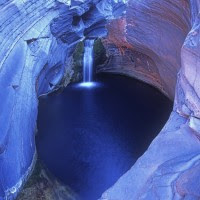
Spa pool Karijini National Park

The Pilbara consists of three distinct geographic areas. The western third is the Roebourne coastal sandplain, which supports most of the region's population in towns and much of its industry and commerce. The eastern third is almost entirely desert, and is sparsely populated by a small number of Aboriginal peoples.

These are separated by the inland uplands of the Pilbara Craton, including the predominant Hamersley Range which has a considerable number of mining towns, the Chichester Range and others. These uplands have a number of gorges and other natural attractions. Pilbara contains some of the world's oldest surface rocks, including the ancient fossilised remains known as stromatolites and rocks such as granites that are more than three billion years old.


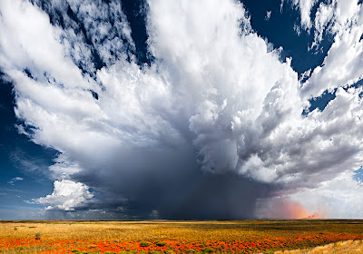
The climate of the Pilbara is semi-arid and arid, with high temperatures and low irregular rainfall that follows the summer cyclones. During the summer months, maximum temperatures exceed 32°C (90°F) almost every day, and temperatures in excess of 45°C (113°F) are not uncommon.


The Pilbara town of Marble Bar set a world record of most consecutive days of maximum temperatures of 100 degrees Fahrenheit (37.8 degrees Celsius) or more, during a period of 160 such days from 31 October 1923 to 7 April 1924.


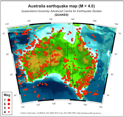
Earthquake map Australia


While the full impact of the devastating Christchurch earthquake in New Zealand continues to unfold, some interesting environmental effects are being revealed.
The Christchurch earthquake caused a 30-million-tonne chunk of ice to break off from the Tasman Glacier, 200 km away in Aoraki/Mount Cook National Park on the west coast of the South Island. The 1.2 km long slab of ice plunged into Tasman Lake.
A group of tourists on a boat in the lake at the time were walloped by giant 3.5 m waves created by the calving. The ice broke up in the water, forming several icebergs, one 250 m long.

The 30-million-tonne chunk of ice


Earthquakes are most destructive at the surface of the Earth, where the energy is released as the ground shaking. This means that when the epicentre is close to the surface, there's not much rock or earth for the tremor to travel through and act as a shock absorber.


Earthquakes do occur in Australia even though the nation does not sit on a tectonic plate boundary like in New Zealand.

The nearest boundary passed through Papua New Guinea to the north, into the Pacific Ocean and south to New Zealand.


Australia experiences "intraplate earthquakes" along fault lines dating back millions of years when parts of the country were on or near plate boundaries.

The greatest earthquake risk in Queensland is in Central Queensland.

A fault line just 30 kilometres west of Bundaberg ( the origin of a quake at least 5.4 in magnitude in 1935 ) has the potential for another large earthquake.

According to Seismologist Dr Kevin McCue of Central Queensland University in Rockhampton, the Australian continent is hit by a magnitude 6 earthquake every five to six years and currently, one is overdue, " so we're just waiting to see what will happen in Victoria ", and he thinks that it is just luck we haven't had an earthquakes under Melbourne and Sydney.

On December 28, 1989, a magnitude 5.6 earthquake struck Newcastle N.S.W, causing extensive damage and killing 13 people.

Earthquakes frequently occur close to plate boundaries, where the plates that make up the earth's crust push and slide against each other.

Despite sitting in the middle of a tectonic plate, scientists say Australia is subjected to the stresses and strains from movements at the edges of plate boundaries. "Compared to Canada, US, South Africa, central Africa and India, Australia is more active.


The warning comes after two moderate-sized earthquakes recently struck the Gippsland town of Korumburra in southeast Victoria. 06/03/2009
Both were felt 120 kilometres away in the city of Melbourne.
The earthquakes registered magnitude 4.6 on the Richter scale, with another small earthquake felt in the area in January 2009. Both struck 15 kilometres below ground and were associated with uplift of the Strzelecki Ranges.


Australian Earthquake warning, two separate geological studies have concluded that an area from Adelaide to south-east Victoria is seismically active and the next 'big one' could endanger lives and infrastructure.


RFDS The Royal Flying Doctor Service


You know you live in a huge and bare country when the ambulance has to operate from the sky.

The Royal Flying Doctor Service is a non profit organisation relying on community support and donations.


Since their first flight in 1928 the Royal Flying Doctor Service has become an essential and iconic part of Australia’s isolated and rural areas. The early flying doctors were the first of their kind and today the RFDS covers more than 7million km2, an area larger than Western Europe.


Today,they own a fleet of 53 fully instrumented aircraft with the very latest in navigation technology. RFDS operate 21 bases across Australia. RFDS pilots annually fly the equivalent of 25 round trips to the moon and RFDS doctors and flight nurses are responsible for the care of nearly 270,000 patients! RFDS have come a long way from that first flight in 1928 which saw the Flying Doctor airborne at last.


Throughout January, the floods caused numerous operational challenges to RFDS.
RFDS was called on to help evacuate hospitals and nursing homes ahead of the floods in St George, Emerald and Goondiwindi. This was made difficult by the fact that Rockhampton airport flooded, forcing the closure of their base and maintenance facility for almost a month. The Brisbane Airport Base and Brisbane head office were also closed to non-essential staff for a short time. They were able to relocate their aircraft and crews to other bases, minimising service disruptions.


Some RFDS employees, like other locals, were isolated by the flood waters. One Bundaberg pilot required emergency services to ferry him across a flooded river so he could access the base and fly the aircraft.


Coordination involved some round-the-clock sessions in managing the availability of additional staff and the positioning of aircraft and staff to be able to respond to tasks.

As you know The Royal Flying Doctor Service is a non profit organisation relying on community support and donations.


Please Help with a small donation


Mud Crabs

Mud Crabs are marine and estuarine coastal dwellers that can tolerate low salinity for extended periods, preferring shallow water with...